Road Trippin’ Off the Beaten Path
Please note: As our world slowly reopens, some of our businesses and attractions may not be fully accessible to the public as we find our way forward, but we invite you to make the most of your road trip in The County.
Article by George Amaro & Karen Orme
If there’s one thing that the COVID-19 pandemic has taught us, it’s how to re-think … well … everything.
Being ready to ‘rethink’ is a smart approach when you visit The County, and it’ll probably make your trip a whole lot more enjoyable and personal, while giving you a unique view of this beautiful region.
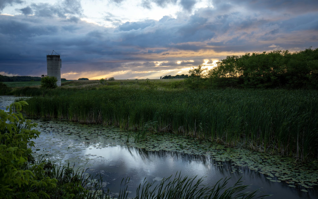
Try turning your visit upside down and inside out. Maybe it’s visiting in the fall or winter – both are spectacular! Perhaps it’s planning your meals at non-traditional times, or it simply may be getting away from it all – literally – and going beyond the beach and the beaten path. No matter when you visit, or where you go, The County is beautiful all the time!
On Roads Less Travelled
To help plan your County road trips, we’ve put together four driving tours that will whisk you away from the normal hubs and hotspots. We’ll introduce you to different areas of The County along twisting, winding, scenic roads, past serene, pastoral countryside, and with stops at some of The County’s hidden gems.
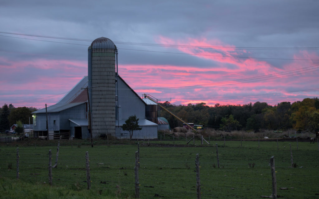
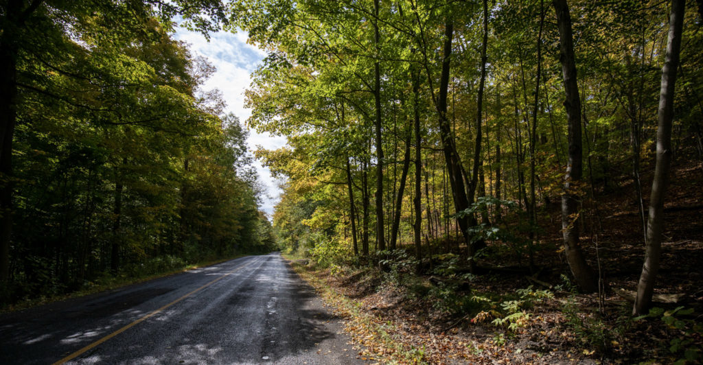
No matter what time of year you visit, The County is stunningly beautiful in any season. It transforms from a thousand shades of summer greens into the warm golds and fiery reds of autumn, before being blanketed by the soft whites of winter’s breath, then slowly re-emerging with spring’s warming touch.
And remember, drive only where you’re supposed to, obey the speed limit, park only where designated, and leave our home as beautiful as you found it.
Now, gas up, get in and go!
Where to? Ameliasburgh
North and Northwest County
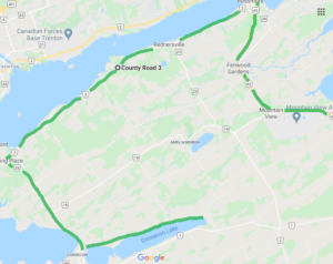
- Route: County Road 3, Highway 62, Lakeside Drive, Loyalist Parkway (Hwy 33)
- Detours: Burr Road, Christian Road, County Road 19, Salem Road, Victoria Road
- Length: 60 km, 55 minutes
- Places: Ameliasburgh, Carrying Place, Consecon, Rednersville, Rossmore
- Historical highlight: Ameliasburgh Museum & Pioneer Village (seasonal)
- Scenic highlights: Christian Road, County Road 3
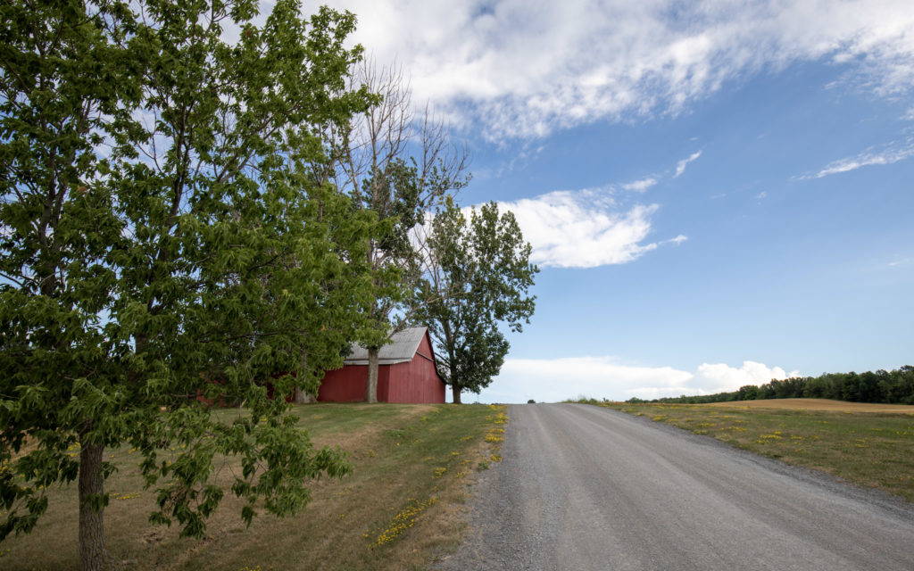
Description: There are great views of the Bay of Quinte along County Road 3, with its stylish homes and lush, expansive lawns stretching from the road to the water. It’s a smooth drive in any season, and particularly beautiful in the summer and fall, because of its large, mature, deciduous trees.
Highway 62, a main artery leading to the bridge to Belleville, features a scenic, winding road with different elevations, and expansive views of the Mountain View air field.
Lakeside Drive, in the southwest part of Ameliasburgh, hugs the tree-lined north shore of Consecon Lake, making for a scenic drive, especially in the fall, but pretty any time of the year.
Cool factor: Al Purdy, Canada’s “unofficial poet laureate,” lived near the village of Ameliasburgh. His iconic A-frame home has been graced by a who’s who of the country’s literary elite such as Margaret Laurence, Margaret Atwood, Michael Ondaatje, and many others. It’s now the home of the A-frame Residency Program for Canadian writers.
Worth a Stop:
To Shop: The Sword Antiques, Young’s Antiques & Vintage Cottage Decor, The Dressing Room, The Green Root, Gilmour’s Meat Shop and Deli
To Dine: Tabersnack, Strato’s Pizza & Restaurant
To Sip: Apple Falls Cider Co., Terra Estate Winery
To Farm Stand & Food Stuff Explore: Thyme Again Gardens, Campbell’s Orchards, Consecon Honey House, From The Farm Cooking School, Angelo Bean Cooking Studio, Walt’s Sugar Shack
To Art Appreciate: By the Bay Art Studio & Gallery, County Studio, Janet B Gallery & Studios, Florence Chik-Lau, Schoolhouse Basketry, Shadow Ridge Studio & Gallery
To Tour: Ameliasburgh Heritage Village, Massassauga Point Conservation Area
Click here for more suggestions.
Where to? Sophiasburgh
Northeast Corner of The County
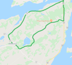
- Route: County Road 5, County Road 15, County Road 49, Fish Lake Road
- Detours: County Road 14, Foster Road, North Road, Potter Road, Water Road
- Length: 33.5 km, 30 minutes
- Places: Demorestville, Big Island, Northport, Fish Lake
- Historical highlight: In the early part of the century, Demorestville was more important and larger than both York (now Toronto) and Meyer’s Creek (now Belleville). As suggested by the name of Gomorrah Road, it has a very colourful past!
- Scenic highlight: Big Island
Description: County Road 15 travels along the northeast part of The County, from the bridge into Tyendinaga to historic Demorestville. It’s a winding, paved road with occasional views of the Bay of Quinte and the Big Island marsh to the north, and farmland and wild tracts of juniper trees to the south.
Fish Lake Road heads in every direction at one point or another – like a lot of roads in The County. It’s a typical country road, very pastoral, and beautiful in all seasons.
Cool factor:
Who could guess that today’s sleepy, tiny Demorestville was once a place of taverns, brothels and general ill-repute, catering to smugglers and those who toiled in the lumber industry? It was even called Sodom, and still bears a road named Gomorrah in reference to those heady days.
Worth a Stop:
To Shop: The Harvest Shed, Demorestville Café & Convenience
To Sip: Three Dog Winery
To Farm Stand & Food Explore: Hawthorne Herbals, Fiddlehead Farm, The County Catch, Jubilee Forest Farm
To Art Appreciate: Stone Cottage Art and Barn Quilt Gallery, Mia Lane Gallery, Ember Studio, Jodi Shuster
Click here for more suggestions.
Where to? North Marysburgh
Easternmost County, Adolphus Reach
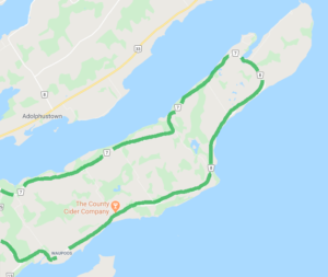
- Route: County Road 7, County Road 8
- Detours: County Road 25, Bongards Crossroad, Cressy Lakeside Road, Kaiser Crossroad
- Length: 54 km, 42 minutes
- Places: Cressy, Glenora, Lake on the Mountain, Waupoos
- Historical highlight: Rose House Museum
- Scenic highlight: Lake on the Mountain
Description: This loop traces the Adolphus Reach on north side (County Road 7) from Lake on the Mountain to Cressy, and Lake Ontario on the south side (County Road 8). The road features plenty of twists and turns – including several S-curves – as it travels past a bucolic, serene landscape of mainly fields and farms. Lots of great views of the water on both sides.
Cool factor: Waupoos is the Ojibwe word for rabbit
Worth a Stop:
To Dine: The Restaurant at Waupoos Estates Winery, Waupoos Pub and Cressy Mustard Co.
To Sip: Cape Vineyards, Del-Gatto Estates, County Cider Co., Waupoos Estates Winery, Clafeld Fruit Winery & Cider House Market
To Farm Stand & Food Explore: Mayphin Farm, Fifth Town Artisan Cheese, Cressy Mustard Co., Creasy’s Apple Dabble Farm, The Blueberry Patch, Koopmans Maple Mountain, Waupoos Acres Farm, Sunnydale Farms
To Art Appreciate: Karolem Art Studio
Click here for more suggestions.
Where to: South Marysburgh
Southeast part of The County
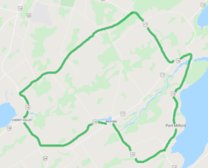
- Route: County Road 10, County Road 13, Miller Road
- Detours: Brewer’s Road, County Road 17, County Road 24, Crowe’s Road, Lighthall Road, Long Point Road, Old Milford Road, Royal Road
- Length: 32.5 km, 35 minutes
- Places: Black River, Cherry Valley, Milford
- Historical highlight: Scott’s Mill is a reminder of an era when sleepy Milford was a booming mill town and famous ship-building centre. It became the Milford Mill Pond Conservation Area after Carson Scott – its last operator – sold it in 1975.
- Scenic highlight: Scott’s Mill at the end of Crowe’s Road.
Description: Starting at County Road 10, Miller Road is a patchwork of farms, interspersed with roadside trees and shrubs. The eastern section of the route follows County Road 13, twisting and winding its way south, through a beautiful, forested stretch of road down into Black River. It’s beautiful any time of year, but especially in the fall when it’s alive with reds, golds, yellows and browns. The bridge offers gorgeous views of the river in either direction.
County Road 13 heads into South Bay and offers the odd glimpse of the water, especially in the fall and winter when the leaves have dropped. The route turns off 13 onto County Road 10 just past Mariner’s Park Museum, before heading west, north and west again back to the starting point at Miller Road. It meanders through farm fields, and past the sleepy villages of Milford and Cherry Valley.
Cool factor:
The Prince Edward County Bird Observatory may be small, but it bands more than 8,000 birds a year!
Worth a stop:
To Shop: Stowaway Vintage, The Store in Cherry Valley, Walker’s Greenhouse
To Dine: The Milford
To Sip: Exultet Estates, Half Moon Bay Winery, Lighthall Vineyards, Long Dog Vineyard Winery
To Farm Stand & Food Explore: Black River Cheese, Vicki’s Veggies, Floralora Flowers, Vader’s Maple Syrup, The Local Food Shop at Quinta do Conde, Curious Goat General Store, Ruth’s Canteen, Hawkridge Homestead
To Art Appreciate: Blizzmax Gallery, Pete’s Stained Glass, Holly Sedgewick, Graham Davies The Bald Photographer, Judy Plomer Studio, Aidan Haley Studio
To Tour: Mariner’s Park Museum, Prince Edward Point Bird Observatory
To Do: Cabin Fever Kayak
Click here for more suggestions.